I built Oginify — a free OG image generator. 3x daily, no signup. Try it →

AI Creative & Design

3D Scanners: From Reality to Digital Models

Quickly digitize the real world while preserving every detail. AI 3D scanners offer high-precision scanning, intelligent reconstruction, and data processing for cultural heritage, industrial design, and medical applications.

·Updated May 18, 2026·13 min read
3D Scanners: From Reality to Digital Models — hero illustration

What Are 3D Scanners

3D scanners capture real-world object shapes, textures, and colors to create accurate 3D digital models. Using cameras, LiDAR sensors, or structured light projection, these devices and apps rapidly convert physical objects into digital representations without manual modeling. Their core value lies in bridging the physical and digital worlds — enabling quick digitization for heritage preservation, e-commerce product displays, architectural documentation, manufacturing QA, and robotics simulation.

In 2026, the technology has split into three distinct routes. Photogrammetry (multi-angle photo reconstruction) produces editable meshes suited for 3D printing and CAD. 3D Gaussian Splatting (3DGS) represents scenes as millions of colored 3D ellipsoids, rendering at 60+ FPS with real-time photorealism — ideal for visualization, sharing, and digital twins. Neural Radiance Fields (NeRF) encode scenes into neural network weights, excelling at complex lighting and reflections but slower to train. The rise of on-device processing (PocketGS research on iPhone 15; Scaniverse shipping) means high-quality 3D capture no longer requires cloud uploads — a breakthrough for privacy and offline workflows.

After scanning, captured models often require refinement: 3D Modelling provide precision editing for mesh repair, retopology, and detail sculpting. AI 3D model generators handle the inverse workflow — creating models from text or image prompts rather than physical capture. Together, scanning, modeling, and generation form a complete pipeline.

How 3D Scanners Work

AI 3D scanners reconstruct 3D geometry through three core technology routes. Photogrammetry (SfM+MVS) triangulates surfaces from multi-view photos — mature, survey-grade (±1–3cm with GCPs), but struggles with reflective or featureless surfaces. 3D Gaussian Splatting (3DGS) represents scenes as millions of oriented 3D Gaussians with position, covariance, color, and opacity — rendering at real-time 60+ FPS, handling glass, vegetation, hair, and reflections that break traditional pipelines. GS's key 2026 milestone: OpenUSD officially supports GS, and GS-to-Mesh conversion (KIRI Engine) now enables export to traditional 3D workflows. Neural Radiance Fields (NeRF) encode scenes as neural network weights — unmatched for complex lighting and view synthesis, but training is slow and the output is not directly editable. The 2026 trend: hybrid pipelines combining LiDAR geometric accuracy with GS photorealism for digital twins.

  • Real-time photorealism: 3D Gaussian Splatting renders scenes at 60+ FPS with photorealistic quality, handling materials (glass, reflections, foliage) that photogrammetry cannot — making scans instantly shareable and visually compelling.
  • On-device privacy: 2026's on-device processing breakthrough — research (PocketGS on iPhone 15, ~5 min, <3GB RAM) and commercial apps (Scaniverse) now run full 3DGS training locally — no cloud upload needed. Critical for sensitive sites, offline environments, and instant results.
  • AI scan guidance: New tools like HoloTwin HT Scan use on-device AI to evaluate scan quality in real time — flagging missing surfaces, poor lighting, and coverage gaps before you leave the site. Eliminates the most expensive part of scanning: redoing it.
  • Multi-modal fusion: Modern pipelines fuse LiDAR (geometric accuracy), photogrammetry (texture detail), and GS (photorealism) into unified outputs. DJI Terra and Xgrids handle this hybrid approach at scale, from single objects to city-sized captures.

Scanner tools differ fundamentally by their technology route and end goal. Photogrammetry-based tools (KIRI Engine's mesh mode, Polycam photo mode) output editable OBJ/STL meshes — the right choice when you need to edit in Blender, 3D print, or do CAD reverse engineering. 3DGS-based tools (Scaniverse, KIRI GS mode, Luma AI) prioritize visual quality and real-time rendering — ideal for sharing, embedding, and digital twins where photorealism matters more than editability. LiDAR tools (Dot3D, SiteScape, Canvas) provide absolute scale and work in poor lighting — the choice for AEC documentation and room-scale measurement. Hybrid enterprise platforms (HoloTwin, DJI Terra, Artec) fuse multiple capture modalities with AI semantic segmentation for industrial deployments. The key decision: are you scanning for editing/measuring (choose photogrammetry or LiDAR) or for showing/sharing (choose 3DGS)? For refinement, AI 3D modelling tools provide mesh repair and retopology. For generating synthetic 3D assets, 3D Model Generator create geometry from text prompts; World Model provide environment-scale reconstruction.

2026 Best 3D Scanners: Reality to Digital & Professional Measurement

Top 3D scanners for 2026, covering smartphone scanning, LiDAR scanning, on-device GS processing, NeRF capture, and professional AEC measurement — five tools that span the full spectrum from free consumer apps to pro-grade documentation.

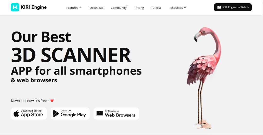
1. KIRI Engine: Smartphone Scanning

KIRI Engine 3D scan result in preview panel, with scan settings and measurement tools visible — Smartphone Scanning

Try KIRI Engine

is a versatile 3D scanner supporting all three major 2026 capture modes: photogrammetry (mesh output), Neural Surface Reconstruction (NeRF-like quality with mesh export), and 3D Gaussian Splatting. Its standout feature is GS-to-Mesh conversion (Pro tier) — scan in GS mode for speed and visual quality, then export as an editable OBJ mesh for Blender, Unreal, or 3D printing. v4.0 (2025) removed export caps entirely — unlimited free exports. Supports object, room, face, and AR-guided scanning. KIRI Engine runs on both iOS and Android, with cloud processing for heavy workloads. Pricing: free tier + Pro ($17.99/mo or $79.99/yr). For creators who need a scan that can go from capture to production pipeline without switching tools, KIRI Engine is the most complete consumer option.

2. Polycam: LiDAR Scanning

Polycam 3D scan result in preview panel, with scan settings and measurement tools visible — LiDAR Scanning

Try Polycam

supports smartphone 3D scanning with an intuitive interface and a community Explore library of millions of public models. Using iPhone/iPad LiDAR sensors and cameras, Polycam creates high-quality 3D models in LiDAR, photo, and 3DGS modes. Real-time preview during scanning helps ensure coverage. The community aspect — browsing others' scans to learn techniques — is unique among scanning apps. Polycam's 3DGS mode competes directly with Scaniverse, while its photogrammetry mode rivals KIRI Engine. Free tier available; Pro from $17.99/mo. For users who want a polished, community-backed scanning experience across multiple capture modes.

3. Scaniverse: On-Device GS Processing

Scaniverse on-device 3D Gaussian Splatting scan result, showing room-scale capture processed entirely on iPhone

Try Scaniverse

by Niantic is the first consumer app to process 3D Gaussian Splatting entirely on-device — no cloud upload required. On iOS (iPhone Pro/iPad Pro with LiDAR), Scaniverse creates photorealistic room-scale 3D captures with real-time processing on the device's Neural Engine. Android support is also available (photogrammetry-based, no LiDAR required). The app is completely free with no export limits — a rarity in 2026. It also supports mesh simplification and built-in social sharing. For privacy-sensitive projects (factories, client sites, residential interiors), offline environments (construction sites, mines, remote locations), and anyone who wants instant results without waiting for cloud processing, Scaniverse is the zero-cost, zero-privacy-compromise option.

4. Luma AI: NeRF Quality Leader

Luma AI NeRF 3D capture showing complex lighting and reflections on a glossy object

Try Luma AI

captures 3D scenes using Neural Radiance Fields (NeRF), delivering unmatched photorealism for complex lighting, reflections, and transparent surfaces. iOS only; free cloud processing turns phone captures into high-fidelity NeRF models exportable to Blender, Unity, or Unreal. While Luma retired its Flythroughs and Genie products in early 2026, its core Interactive Scenes NeRF platform remains active, and its rendering quality remains the benchmark in the consumer space — no other app matches its handling of specular highlights, subsurface scattering, and ambient occlusion in captured scenes. For artists, concept designers, architects presenting visual concepts, and anyone prioritizing visual quality over geometric editability, Luma AI produces the best-looking captures you can get from a phone.

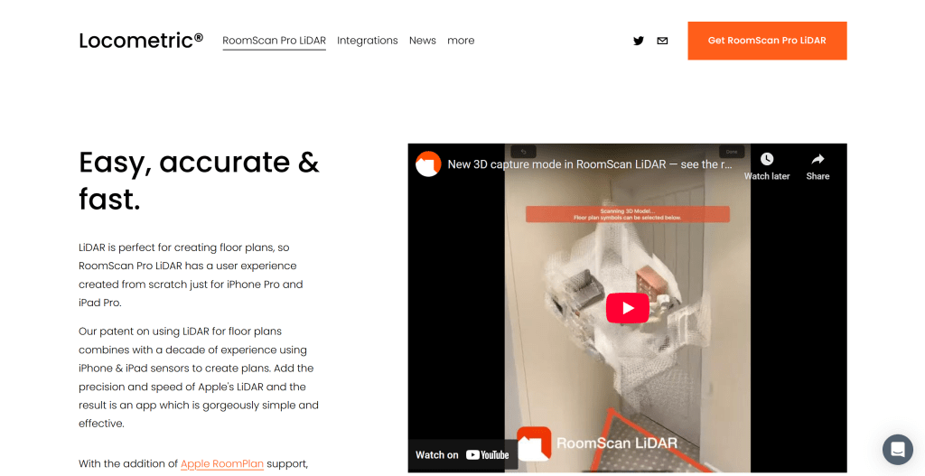
5. Dot3d: Professional LiDAR + AEC

Dot3D professional LiDAR scanning interface showing real-time point cloud with measurement annotations

Try Dot3D

is a professional-grade LiDAR scanning app purpose-built for architecture, engineering, and construction (AEC) workflows. Unlike consumer apps, Dot3D offers real-time SLAM loop-closure correction, AprilTag targeting for survey control, and NeRF/GS frame export to third-party software. It captures millimeter-accurate measurements with fully on-device processing — no cloud dependency, no data leaving the site. Pricing: free trial, then $49.99/month (Pro) or $349.99/year. For architects documenting existing conditions, surveyors capturing as-built measurements, and construction teams who need scan data that holds up in Revit and AutoCAD, Dot3D bridges the gap between consumer convenience and professional requirements.

3D Scanners Comparison

Here's a detailed comparison of the top 5 3D scanners spanning consumer apps to professional tools — covering technology, best use case, platform support, and pricing:

Tool NameCore FeaturesBest ForPricing
KIRI EnginePhotogrammetry + NSR + 3DGS, GS-to-Mesh conversion, unlimited free exportsCreators needing production-ready meshes — 3D printing, game assets, product visualizationFree + Pro ($17.99/mo)
PolycamLiDAR + photogrammetry + 3DGS, community Explore library, real-time previewMulti-mode scanning with community learning — product 3D, room scans, digital contentFree + Pro ($17.99/mo)
ScaniverseOn-device 3DGS processing, completely free, no cloud upload, mesh simplificationPrivacy-sensitive projects, offline environments, instant results — zero cost, zero cloudFree
Luma AINeRF rendering, unmatched photorealism for reflections/lighting, free cloud processingVisual concept presentations, art captures, architectural visualization — quality over editabilityFree tier + plans from $9.99/mo
Dot3DProfessional LiDAR + SLAM, AprilTag survey control, millimeter accuracy, fully offlineAEC documentation, as-built surveys, construction verification — needs CAD/BIM compatibilityFree trial + Pro ($49.99/mo)

Use Cases: 3D Documentation & Modeling

3D scanning technology has moved from expensive industrial hardware to accessible AI-powered tools that can generate 3D models from smartphone photos or LiDAR sensors — democratizing 3D capture across industries. The use cases vary by required fidelity: consumer-grade scanning for social media AR filters and hobbyist 3D printing, professional scanning for e-commerce product visualization and architectural preservation, and industrial-grade scanning for quality inspection, reverse engineering, and digital twin creation in manufacturing.

Cultural Heritage Preservation

Museums and cultural institutions use scanners to create digital archives of artifacts and historical sites. 3DGS captures fine surface detail (carvings, weathering, textile texture) that photogrammetry alone misses, while LiDAR provides accurate dimensions for restoration planning. Tools like KIRI Engine and Polycam enable phone-based scanning of fragile objects without contact.

Architecture & Interior Documentation

Architects and designers capture existing conditions for renovation and documentation. LiDAR-based tools (Dot3D, SiteScape) output dimensioned floor plans and E57/RCP files for Revit and AutoCAD. On-device processing means scans of client properties stay local. For design presentations, 3DGS captures (Scaniverse) create immersive, walkable 3D views in seconds.

E-Commerce 3D Product Display

Sellers create interactive 3D product views that let customers examine items from all angles. Photogrammetry (KIRI Engine, Polycam) outputs web-ready OBJ/glTF models directly. The GS-to-Mesh pipeline means you can capture products with GS speed and visual quality, then export as standard meshes for Shopify, Amazon, or custom web viewers. Conversion uplift from 3D product views is well-documented across footwear, furniture, and collectibles categories.

Digital Twins & Industrial Operations

Manufacturing plants, warehouses, and infrastructure are creating living 3D replicas that fuse scan data with real-time IoT sensor feeds. Siemens Digital Twin Composer and ABB Genix (both 2026 launches) ingest 3D scans from tools like DJI Terra (drone) and Artec (ground-level) and overlay operational data — asset health, temperature, throughput — onto the spatial model. The result is not just a static 3D model but a queryable, decision-making spatial interface. This is the largest growth market for 3D scanning in 2026.

Reverse Engineering & Manufacturing QA

Scanning existing parts to create CAD models for modification or reproduction. Industrial scanners (Artec Leo/Spider II, 0.1mm accuracy) capture precise geometry; the point cloud is converted to parametric CAD surfaces. For quality control, scanned parts are compared against the original CAD model to detect deviations. AI semantic segmentation now auto-classifies scanned components (fasteners, flanges, welds), accelerating what was previously a manual labeling bottleneck.

Robotics Training & Physical AI

Autonomous robots, drones, and manipulation arms need massive volumes of 3D environment data for simulation training. AI 3D scanners are becoming the data infrastructure for Physical AI — Deep Insight DIMENVUE (WIS 2026 award) and NVIDIA Isaac Sim both position 3D scanning as the first step in creating training environments. This opens a market far beyond traditional 3D scanning use cases, connecting consumer capture tools to the robotics and autonomous systems industry.

How to Choose 3D Scanner

Start with scan purpose — editing and measuring (photogrammetry or LiDAR for editable meshes) versus showing and sharing (splats for photorealism) — because it drives the technology route and everything downstream.

Decide: Editing/Measuring or Showing/Sharing?

This is the most important fork. If you need to edit the model in Blender, 3D print it, or do CAD reverse engineering → choose photogrammetry (KIRI mesh mode, Polycam photo mode) or LiDAR (Dot3D, SiteScape) — these output editable meshes. If you want to share, embed, or create a digital twin where photorealism matters more than editability → choose 3D Gaussian Splatting (Scaniverse, KIRI GS mode) or NeRF (Luma AI). GS-to-Mesh conversion exists but introduces accuracy loss — use it as a bridge, not a primary workflow.

Match hardware and platform

iPhone Pro/iPad Pro users (LiDAR-equipped): you can use the full spectrum — LiDAR apps (Dot3D, SiteScape, Scaniverse), photogrammetry (KIRI, Polycam), and 3DGS. Android users: stick with photogrammetry-first tools (KIRI Engine — best Android optimization, Polycam). If you need professional accuracy and don't have LiDAR, consider a dedicated handheld scanner (3DMakerPro Eagle from ~$3,400, ChaoXiLi AiScan O1 from ~$1,100). For large outdoor sites, DJI Terra + a compatible drone ($2,800–$4,400 software + drone cost).

Pick the processing model

Where does your scan data go? On-device processing (Scaniverse, Dot3D, apps using on-device GS processing) keeps everything local — essential for client properties, factory floors, sensitive infrastructure, and offline sites. Cloud processing (Luma AI, Polycam's cloud modes, DJI Terra cloud option) uses powerful GPU clusters for faster, higher-quality results but your scan photos leave your device. Hybrid (KIRI Engine) caches on-device and uploads when WiFi is available. If you're scanning anything you wouldn't email to a stranger, choose on-device.

Match Scale & Object Type to Tools

Small objects (<1m, detailed surfaces): phone photogrammetry works well — 30–150 photos, turntable setup. Medium (rooms, vehicles): LiDAR excels — 1–5 minute walk-around scan. Large (buildings, sites): drone photogrammetry (DJI Terra) + ground-level LiDAR fusion. Reflective/transparent objects: 3DGS handles these better than photogrammetry. Dark/featureless surfaces (white walls): LiDAR wins because it doesn't depend on visual features. Texture-rich surfaces (stone, wood, fabric): photogrammetry gives the best texture detail.

Budget & Ecosystem Fit

Free-to-start: Scaniverse (completely free, on-device GS), KIRI Engine (unlimited exports), Polycam (limited free tier). Prosumer ($1,000–$4,000): 3DMakerPro, ChaoXiLi AiScan O1 — dedicated handheld scanners with AI-assisted capture. Professional software-only ($50–$350/month): Dot3D, SiteScape — use the LiDAR you already have. Enterprise ($2,800–$25,000+): DJI Terra, Artec, Xgrids — for when scanning is your business. Also verify your target 3D software's supported formats: Blender (OBJ/FBX/glTF), Unreal (FBX/glTF), Web (glTF/USDZ), CAD (STEP/IGES from scan-to-CAD tools like Canvas).

Other Notable 3D Scanners

Beyond the top 5, several specialized scanners serve specific professional niches:

HoloTwin HT Scan — CES 2026 award winner. This upcoming iOS app (summer 2026) fuses LiDAR, photos, videos, and floor plans into unified digital twins using a Hybrid Reality Capture Engine. Its standout feature: Guided Scan Intelligence — an on-device AI that evaluates scan quality in real time, flagging missing surfaces, poor lighting, and coverage gaps before you leave the site. HoloTwin positions itself as the bridge between static BIM models and living operational twins. holotwin.com

DJI Terra — the dominant entry point for drone-based 3D mapping. Its v5.2 release added native 3D Gaussian Splatting support alongside classic SfM photogrammetry, processing up to 30,000 images in batch. Outputs include 3DTiles, PLY, GeoTIFF, and standard mesh formats. For construction sites, open-pit mines, urban planning, and large-scale land surveying where walking the site isn't practical. Pricing: $2,800–$4,400. enterprise.dji.com/dji-terra

Artec 3D — the industrial metrology standard. The Artec Leo (wireless handheld, 0.1mm accuracy), Spider II (intricate geometries), and new Artec Jet (2026, AI-SLAM for autonomous scanning in GPS-denied environments) cover the full spectrum from quality inspection to reverse engineering. For automotive, aerospace, heritage preservation, and manufacturing QC where sub-millimeter accuracy is non-negotiable. artec3d.com

Conclusion

3D scanning in 2026 has crossed a threshold: the technology is no longer bottlenecked by hardware cost or expertise. A smartphone in your pocket can now produce scans that rival dedicated equipment from five years ago. The new frontier is choosing the right technology route for your specific end goal — photogrammetry for editable meshes, 3D Gaussian Splatting for real-time photorealism, NeRF for complex lighting, LiDAR for absolute scale — and understanding when to combine them.

For consumer and prosumer use, KIRI Engine offers the most complete pipeline (capture → GS-to-Mesh → export), Polycam provides the best community and multi-mode experience, and Scaniverse delivers zero-cost on-device GS processing. For professional AEC work, Dot3D brings survey-grade accuracy to your iPad. For industrial deployment, DJI Terra handles drone-scale mapping and Artec 3D sets the metrology standard.

Scanners digitize what already exists; they do not invent missing geometry. Match the capture route to the end use: photogrammetry when you need editable meshes, Gaussian Splatting when you need shareable photorealism, LiDAR when absolute scale and low light matter. Validate against your tolerance—millimeters for AEC, “looks right” for marketing embeds—before you standardize a device.

References

  1. 3D Gaussian Splatting for Real-Time Radiance Field Rendering (Kerbl et al., ACM SIGGRAPH 2023) (ACM SIGGRAPH · 2023)Seminal paper introducing 3D Gaussian Splatting — the point-based differentiable rendering technique that enables real-time novel-view synthesis for scanned scenes.
  2. PocketGS: 3D Gaussian Splatting on Mobile Devices (GitHub · 2026)First open-source implementation of full 3DGS training pipeline on mobile hardware (iPhone 15, <5 min, <3GB RAM), enabling on-device scanning without cloud dependency.
  3. Gaussian Splatting: Guide to Real-Time 3D Capture (Thefuture3D · 2026)TheFuture3D explainer on 3D Gaussian splatting capture rigs, training times, and real-time rendering use cases in 2026.
  4. Best Free 3D Scanner Apps in 2026 With No Export Paywall (Kiriengine · 2026)Kiri Engine roundup of mobile photogrammetry apps comparing mesh quality, export formats, and free-tier limitations.
  5. Digital Twins and Reality Capture at AWE USA 2026 (Awexr · 2026)AWE XR report on enterprise digital twin adoption linking LiDAR, splatting, and immersive visualization platforms.
  6. Siemens Digital Twin Composer at CES 2026 (Automation · 2026)Automation.com coverage of Siemens Digital Twin Composer launching immersive factory twins built from reality-capture data.
  7. ABB Genix and NVIDIA Omniverse Industrial Digital Twins (Automation Magazine · 2026)Automation Magazine report on ABB Genix integrating Omniverse and Azure for plant-scale 3D visualization and simulation.

Your Phone Is a 3D Scanner Now.

Walk around an object, get an editable model. Catalog parts, archive products — no more outsourcing the scan.

Get help

This site uses cookies and similar technologies for analytics, personalized ads (via Google AdSense), and essential functions. By clicking “Accept All”, you consent to our use of cookies. You can reject non-essential cookies by clicking “Reject All”.

Privacy Policy